Divine destination- Dwarka

Religious places have always fascinated me, primarily due to the mythological stories behind each divine destination.
Growing up, I have always heard stories of Lord Krishna and his life incidents. Mahabharat has intrigued me to the core. Thus, this made me visit a place where Lord Krishna had once built his golden empire (sone ki nagari) – Dwarka.

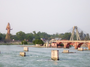
Dwarka is situated on the western end of an Indian state – Gujarat. It is very well connected with road and rail. The nearest airport is located at Jamnagar which is approximately 45 kms from the temple.

Dwarka is also one of the dham from the famous ‘Chardham’ – the other three being Badrinath, Puri, and Rameshwaram. In Hindu mythology, it is believed that one should visit Chardham once in a lifetime to attain Moksha – peace. ( p.s. I am halfway through).

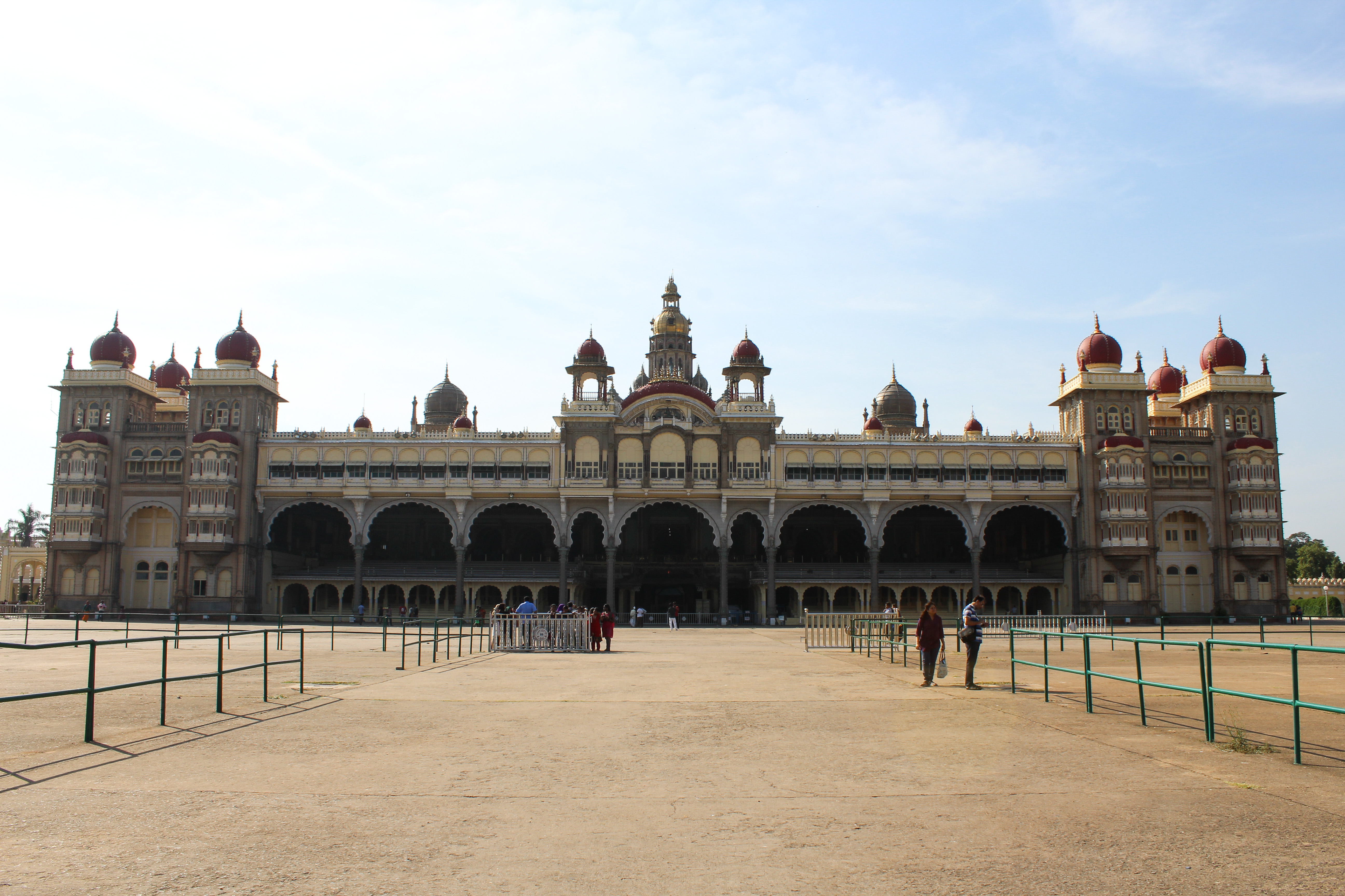
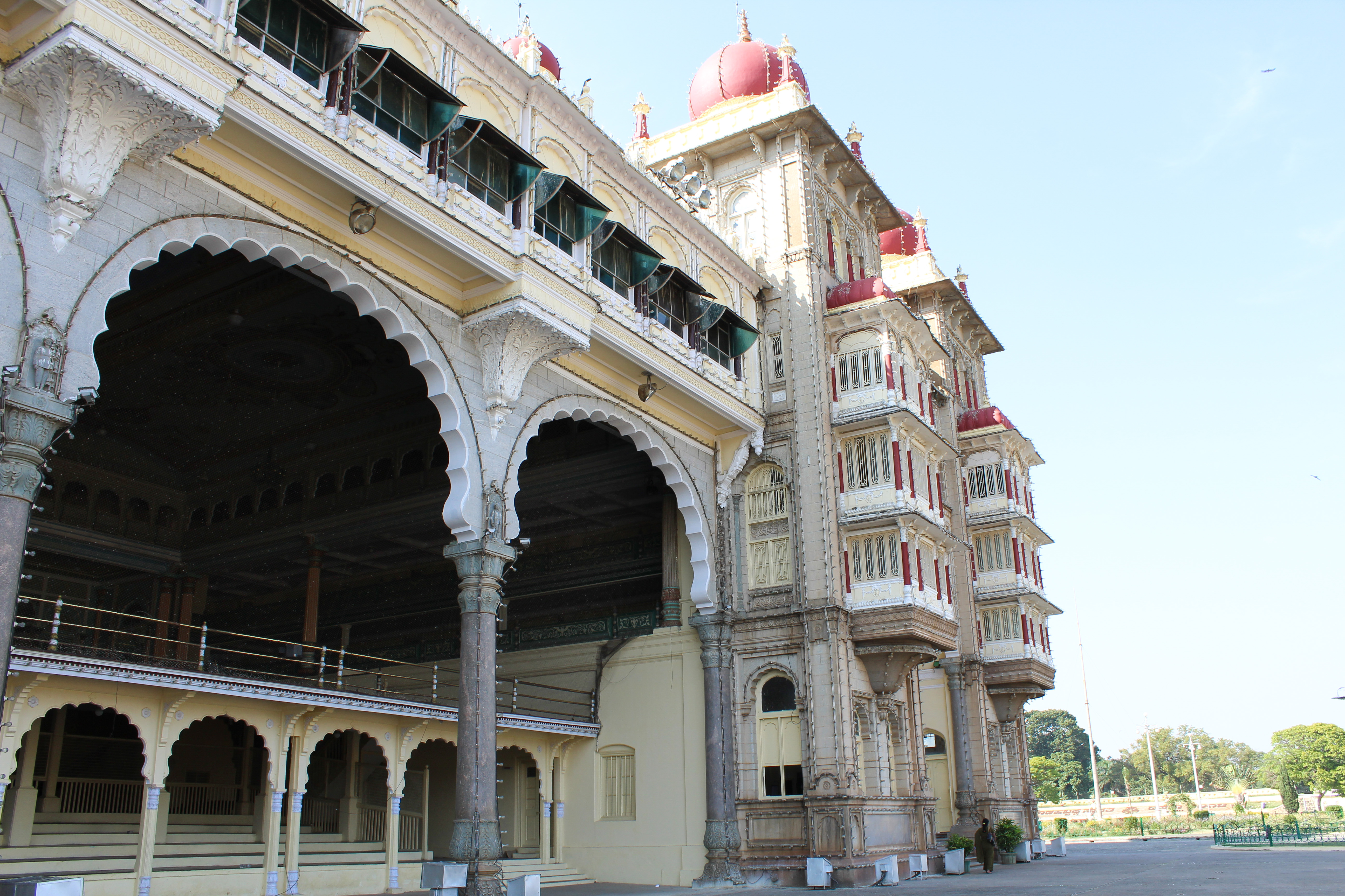
Dwarka, like any other pilgrimage site, has a large number of tourists/pilgrims round the year. The main Dwarka temple proudly stands tall in the heart of the town flanked by mesmerizing views of the Arabian sea.

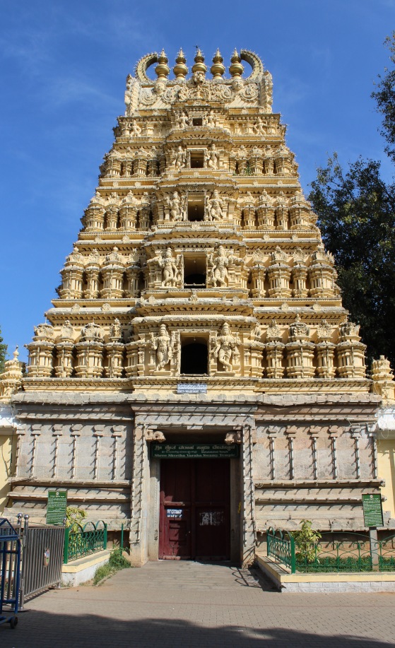
The Dwarkadhish temple is believed to be around 2500 years old and is one of the heritage sites of India. After leaving Mathura, Lord Krishna had built an entire kingdom of Dwarka where he once lived with his queens and an unsullied army known as ‘Narayani Sena’. It is said that Lord Krishna originally resided in ‘Bet Dwarka’ which is around 3 kms, off the coast of Dwarka.

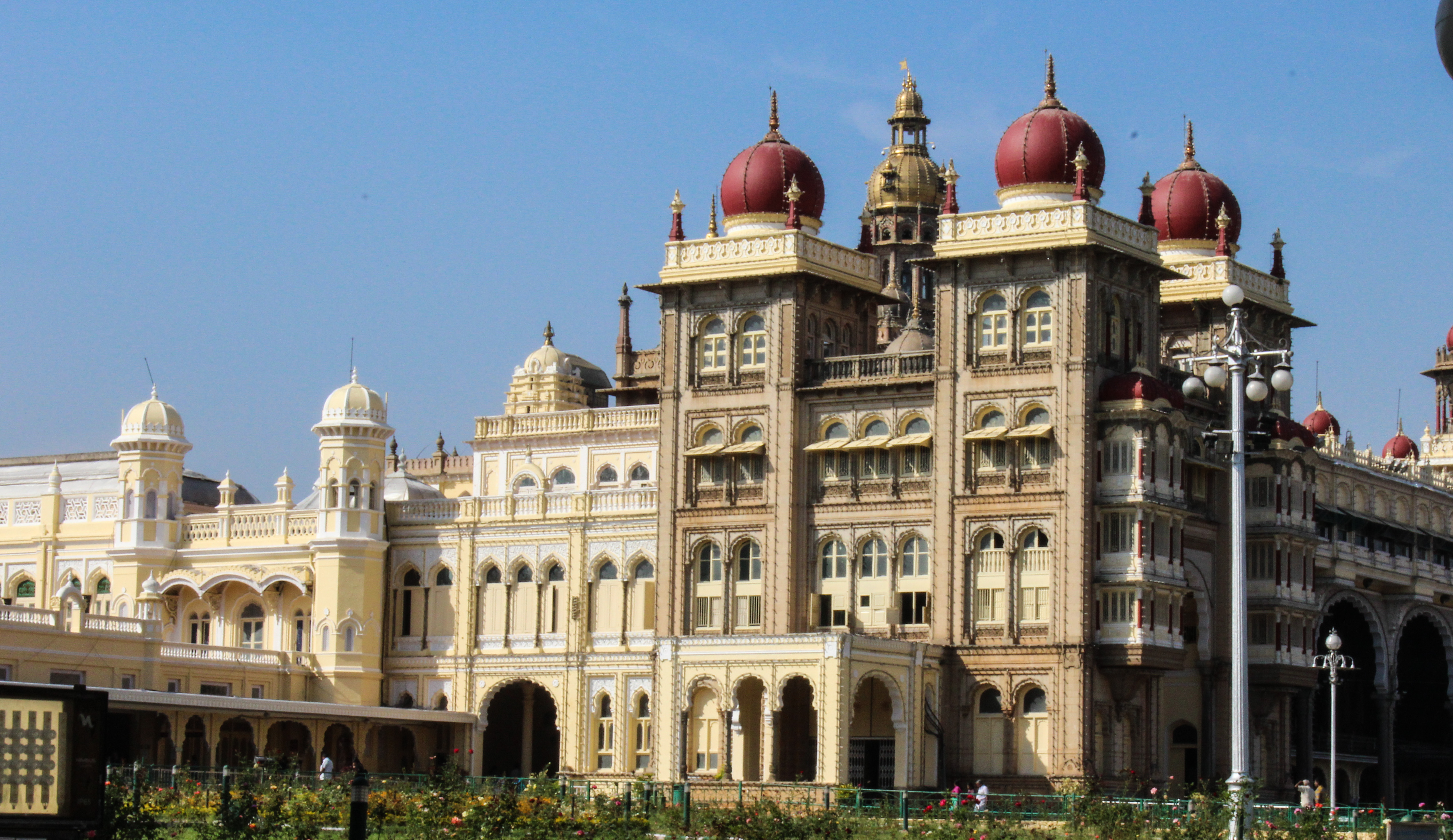
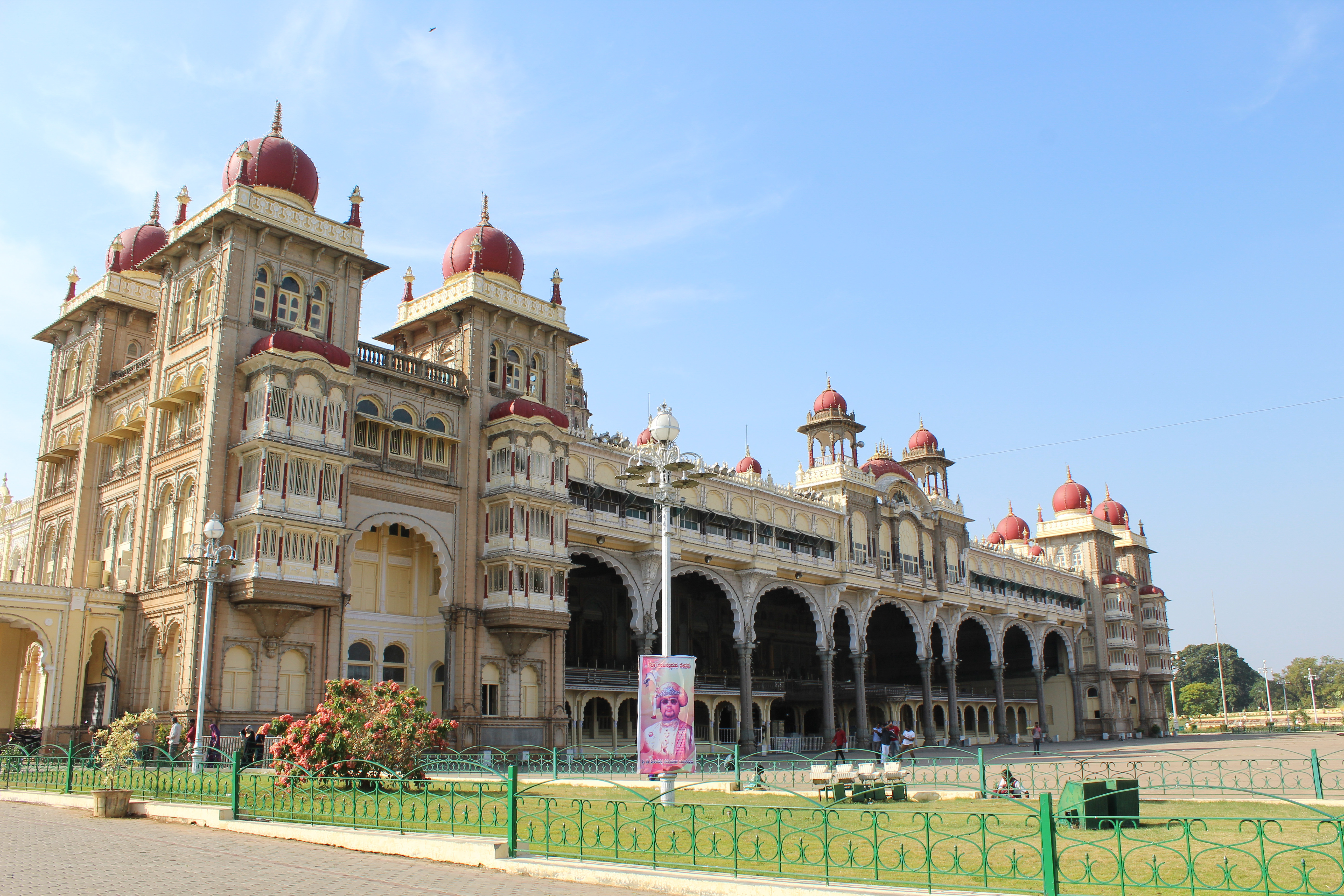
The Dwarkadhish temple is open for darshan on all 7 days between 6.30 am to 1 pm in the morning and 5 pm to 9.30 pm in the evening. The main temple is made from sandstone with beautiful carvings and designs. Camera and mobile phones are strictly prohibited inside the temple premises.

Queues are generally long throughout the day but when you reach inside the main temple, even a small glimpse of Lord Dwarkadhish (Lord Krishna) will leave you spellbound. His presence inside this historical temple is absolutely magical and pure.

After seeking Lord Krishna’s blessings, one can spend some time at Gomti Ghar nearby and savor some delicious street food around the temple premises.

Gomti Ghat

Apart from the beautiful temple, what caught my attention was the breathtaking Dwarka beach near the temple. The water of the sea was visibly clear and turquoise in color. It reminded me of the beaches in a foreign location. There is also a lighthouse near the coast offering panoramic views of the temple and Arabian sea.


According to mythology, after the end of Maharbharat war , Lord Krishna was cursed by Queen Gandhari and the entire golden nagari of Dwarka was submerged under the sea. It marked as an end of an era of Lord Krishna.

A 2 day visit to Dwarka can be a fulfilling experience. One can also combine nearby places like Somnath, Diu and Gir to experience vibrant Gujarat.

Remebering Lord Krishna with a verse from Bhagwad Gita

yada yada hi dharmasya
glanir bhavati bharata
abhyutthanam adharmasya
tadatmanam srjamy aham

paritranaya sadhunam
vinasaya ca duskrtam
dharma-samsthapanarthaya
sambhavami yuge yuge

Trek to the ‘Valley of Flowers’

India is truly blessed to be gifted with beauty of the mighty Himalayas. With it’s magnificent presence over 10 states, Himalayas offer varied views across all the places. One such unique and astonishing place is the ‘Valley of Flowers’ located in the state of Uttarakhand. In this blog, I will quickly share my experience and day wise itinerary on ‘Trek to the Valley of Flowers’.

So, are you ready for this mesmerizing photo journey?

To begin with, I am not at all an experienced trekker, in fact, frankly this trip was my first full fledged trek. I would say for a beginner like me, the difficulty level of the trek was kind of a ‘Medium’ level.

Let’s start with some quick facts on how to reach the place:

Nearest Airport: Dehradun Airport
Nearest Railway Station: Haridwar
Nearest Populous Town: Joshimath
Best time to visit: Between July to September

Day 01: Reaching Joshimath via Haridwar

We started our journey with a flight from Mumbai to New Delhi, followed by an overnight train journey from New Delhi to Haridwar.

It is 5 AM and here we are standing at the Haridwar station sipping hot tea and waiting for our cab driver to take us to Joshimath. Distance is approximately 275 kms but the overall journey duration goes up to 10 hours, provided roads are smooth and landslide-free. By the way, landslides are very common in such hilly area specially during monsoon season.

We reached Joshimath at around 6 PM after a long and tiring journey, though a scenic one. We chose an home-stay to spend the night. It was situated at the outskirts of Joshimath amidst lush green mountains.

Day 02: Joshimath to Ghangharia via Govind ghat

We started early from Joshimath to reach Govind ghat which is the closest place you can get by road. From Govind ghat, it is a 13 kms trek along a steep, narrow, but well defined mountain trail to reach at the base camp in Ghangaria.

Helicopter facilities are also available to reach Ghangaria as it also serves as a base camp to reach the very popular and holy place of the Sikhs, the ‘Hemkund Sahib’.

The 13 kms trek was like a prep for our main expedition to the valley on the next day.

Day 03: Ghangaria to the ‘Valley of Flowers’

Finally, the big day has arrived and we were eagerly waiting to witness the amazing creation of nature. Ghangaria to Valley of Flowers is approx. 6 kms one way trek mostly through stone covered and sloppy roads. The only option to reach there is by foot or by ‘doli’.

After walking for about an hour atleast, we reached the check post/gate to the valley of flowers to get a permit entry. There were multiple informative boards explaining the route map and names of the different flowers that grows in the valley.

From here, we officially entered the ‘Valley of flowers’ national park. The path ahead was narrow, rough and entirely stone covered. Even though it was a 6 kms trek, we took almost 4 hours to reach the main valley. However, the views throughout were extremely surreal, pure and mesmerizing.

The valley of flowers has many different colourful flowers changing their shades in every month from June to October. It is also home to endangered species like Snow Leopard, Asiatic Black Bear, Musk Deer and Red Fox. The sightings of these animals are very very rare.

We reached at the main valley around noon and it was pretty cloudy and rainy. It is highly recommended not to stay at the top beyond afternoon as the weather starts to change drastically.

After capturing each moment with eyes and camera, of course, we headed down back to Ghangaria. We spent rest of the evening interacting with a local photographer who willingly showed us his amazing work on capturing the valley and wildlife across seasons.

Day 04: Leisure/Visit to Hemkund Sahib

The day was spent at leisure in Ghangaria. One can also visit Hemkund Sahib which is also a similar trek from Ghangaria.

Day 05: Ghangaria to Joshimath via Govind ghat

We started early again to reach Govind Ghat and then back to Joshimath. After reaching Joshimath, it started raining very heavily throughout the night.

Day 06: Joshimath to Haridwar

In the morning, we got the news that the roads to Haridwar via Chamoli were blocked both ways due to multiple landslides. Today, we had a long journey from Joshimath to Haridwar. But little did we know that it was going to turn out to be an adventurous one. With courage, we started from Joshimath, after an hour, we somehow managed to reach at the landslide spot area near Chamoli district to decide next steps.

Tourists and locals were stranded for about 12 hours. We had 2 options, either to wait for the road to get repaired or walk across the damaged road anyhow to reach Haridwar railway station for our train to New Delhi. We chose the latter one and decided to take a pedestrian route (by climbing a mountain and trek for 2 kms with luggage bags) and reach the Chamoli Bus station/taxi stand. We jokingly called it as our ‘out of syllabus trek’. After, reaching the bus stand, we saw too many people like us trying to get a taxi or a bus for Haridwar and we somehow managed to get a sharing taxi for Haridwar.

After a chaotic day, we spent the evening peacefully at the Ganga Ghat listening to the sounds of Holy river.

Day 07: Haridwar to Mumbai via New Delhi

Back to the bay, our trip ends here filled with innumerable memories and unforgettable experiences.

Hope you all enjoyed this photo journey!

#stayhome #staysafe #thistooshallpass

Swiss Made!

What comes to your mind when you hear or read “Swiss made” ? Is it Chocolates, Branded watches, Knives, Banks or Yash Raj movies ?

Well, Switzerland has it all! A very popular destination among the tourists, especially Indians. So what makes Switzerland so much unique and popular? There are hundred reasons, but specially for Indians, all credit goes to the Bollywood movies that were shot there in 80’s and 90’s with our beautiful actresses dancing in the backdrop of the Alps!

2016-18-9-01-43-22
In case you don’t believe me, here’s the proof !

But this is not it. Switzerland is a small yet economically strong and politically neutral country. It has a perfect blend of nature and infrastructure. Also, they have still managed to preserve their culture and heritage just like any other European country.

In this post, I will quickly take you around some of their very popular and beautiful places. So let me first begin with, on how to travel in Switzerland. Of course, if you are going through a packaged tour, you may not have an option but to travel with them in their shared coach/bus, but this blog is for those who choose to visit Switzerland on their own. In the latter case, I would always recommend to explore the country by rail! Yes, you read it correct, Trains!

The entire country is very well connected by trains/metro. All you have to do is buy a Swiss Rail Pass which comes in various options to choose from. They even have various panoramic trains such as Glacier Express, Golden Pass, Bernina Express and many more. But that’s not it, Swiss Pass even offers discounts on various museums, entry fees, cable cars and ferry.

2016-18-9--01-36-15.jpeg

So now we know “How to Travel”,  let’s now jump on “Where to Travel”.

A visit to any country is little incomplete without a stopover at their capital city. Bern is the capital city located in central Switzerland and it’s old town area is a popular World Heritage Site.

Moving on to the largest city of Switzerland which is Zurich.

Zurich is located in the north of the country. It is very well connected to most of the cities of the world. Zurich has beautiful combination of old town art and a modern city charm with tall glass buildings as well as heritage stone structures. Strolling along the main street, you will find all major high street brands and beautiful lake-side cafes offering delicious hot chocolates and Swiss cheese fondue.

Zurich

 Next is another very popular city – Geneva.

Geneva serves as a headquarters to World Health Organisation (WHO), World Trade Organisation (WTO), International Labour Organization, CERN and many more…

This vibrant town is located on the shores of Lake Geneva. A cruise ride is a must to-do if you want to explore very old medieval houses alongside the lake. Also, one can tour the streets passing by these famous headquarters.

From Geneva, one can take a quick detour to this splendid little place – Montreux. It is known for the medieval island castle- Chateaux de chillon and some really good wines.

Now, it’s time to add some glamour and winter feel to our Swiss itinerary. We head straight to the very popular Mt. Jungfrau and Mt. Titlis located at the mountain tops. Switzerland has many other mountain tops as well like Glacier 2000, Mt Pilatus, Schilthorn etc. All these places are a full day excursion. So, if you have limited time in the country, you can opt for any two from the above.

Coming back to Mt. Jungfrau, it is situated at 4,158 meters above sea level. You will have to start the trip from Interlaken – another gorgeous town located between the two lakes, serving as a base to many mountain top excursions and caters to world class adventure sports activities.

Fasten your seat belts as you embark upon Europe’s highest rail journey to reach Mt. Jungfrau. Enjoy breathtaking views from the observatory, play with the snow and take some amazing pictures with the alps.

Next very popular mountain top is Mt. Titlis located at an altitude of 3,238 meters and can be reached from Engelberg via rotating cable cars. Indulge yourself in piping hot chocolate and Swiss ice-cream in sub-zero temperatures.

Heading to the south, there is an amazing car free town – Zermatt. It offers an unparalleled view of Matterhorn which is a triangular snow caped mountain, found mainly on the outer cover of Toblerone chocolates. A night stay is preferred here to enjoy Matterhorn in it’s full glory.

If you are looking for some celebrity approved luxurious ski resorts then Gstaad and St. Moritz are the places for you. St. Moritz can also be reached by world’s SLOWEST express train..yes you read it correct – Glacier Express. It is an eight hour long journey connecting St. Moritz and Zermatt.

Well, speaking of panoramic trains, personally I have enjoyed Golden Panoramic train a little more. This train connects Montreux to Zweisimmen offering spectacular views of valleys and alps.

To be frank, none of my words here could truly define the beauty of this heaven, but nonetheless I hope they will surely compel you to visit this beautiful country to experience nature at it’s best.

Currently, the entire world is going through a very tough phase, but we need to be patient and pray that this too shall pass soon.

#staysafe #stayhealthy.

An evening at Lord’s

Well my love for cricket compelled me to write a post on a cricket stadium, but wait this is not an ordinary stadium ! It is one of the most prestigious and beautiful stadium in the world.

Yes I am talking about the ” Home of Cricket”, ” Mecca of Cricket”- Lord’s.

Welcome to LORDS’S

IMG_5617.JPG

IMG_5616.JPG

Entrance Gate


As we entered, a very warm and veteran stadium guide welcomed us. He was more than happy to take us around the stadium. But, for me there was one more surprise waiting inside. What happens when you meet one of your favorite cricketers at your favorite stadium ?

Happiness level= infinity = speechless for a while

Alastair Cook, England Test Captain and a recent new member of the elite 10,000 runs club happened to be there at that time. And the best part was he happily agreed to click pictures with us and I had a quick chat with him as well . It was so surprising to see cricketers there moving around so freely without any fuss or security unlike in our country.

It took me a while  to come back from the surprise and happy state to normalcy, and now it was the time to enter the staircase area from where cricketers enter the stadium.   Photography is prohibited in the staircase area.

IMG_5625.JPG

Dressing Room of the cricketers.

IMG_5624.JPG

When I see Rahul Dravid’s name anywhere, picture is mandatory!!

It is a dream of every young aspiring cricketer to score a century at Lord’s. But it is not so easy to make it to the above list ! You wont believe this but Sachin Tendulkar has never scored a century at Lord’s ! Surprising, isn’t it ?

For us Indians, the first two events that come across our minds when we hear or read about the Lord’s is one- India lifting the their very first World Cup way back in 1983 and the second one, Saurav Ganguly waiving his Tshirt from the Lord’s balcony . Well, the second one did create a lot of buzz during that time.

IMG_5626.JPG

The view of the stadium from the balcony

IMG_5632.JPG

Famous Balcony from where important people enjoy the game

IMG_5627.JPG

Media center

IMG_5630.JPG

After giving us a lot of interesting facts and figures, the guide took us to the Lord’s museum where they have kept the  1983 World Cup Trophy , Ashes Trophy and many other paintings and portraits.

IMG_5634.JPG

World Cup Trophy

IMG_5635

Ashes Trophy

IMG_5638.JPG

Do I need a caption ?

Now it was the time to actually sit in the stands and feel the view. And trust me the view from the stands was breathtaking. It even made me imagine a match going on between India and England with Sachin and Dravid on crease. 😉

IMG_5646.JPG

View from Stands

IMG_5648.JPGIMG_5644.JPG

It was time to bid adieu however the experience was overwhelming. To end this I would say, for all the cricket lovers this place is something really awe-inspiring, but for the rest it is just another stadium !

IMG_5615.JPG

3 Must Visit Places in Mysore !

So far, most of my blogs were based on places in North India, so let us break the trend and let me take you across 3 different cities in South and West India.

Yes, in my next series of blogs, I will take you around 3 distinct and beautiful cities of India, starting with Mysore, then Hyderabad and finally my very own city, Aamchi Mumbai.

Let’s start our Tri- City tour with the city which was voted as cleanest city in India as per Swachh Bharat rankings- Majestic Mysore !!

Well, there are endless places one can visit in and around a city, but considering limitations of time and budget as well, I found that if you are on a 1 or 2 day visit to Mysore, you should not miss on these places.

1. MYSORE PALACE

Mysore Palace is one of the most popular and famous tourist attractions of Mysore. It is the official residence of Maharajas of Mysore. Architecture and History enthusiasts will surely enjoy the beautiful blend of Indian, Gothic and Rajput designs inside the palace. And for rest of us, the grandeur and majesty of the palace is pretty enough to impress. The tour around the palace  usually takes around  1 to 2 hours.

Palace Timings: All days- 10AM to 5.30PM

Illumination timingsSundays & Public Holidays :7pm-7.30 pm.

If possible, try to visit on a Sunday evening, as the entire palace is illuminated with over 96,000 lights !! The view is astonishing.


IMG_0295_edited

Mysore Palace – Full View

IMG_0283_edited.jpg

IMG_0303_edited

IMG_0285_edited

Shveta Varaha Swami Temple inside the palace complex

IMG_0298_edited.jpg

Closer look

 2. Mysore Zoo

If you are an animal lover and want to see all your favorite species at one place, Mysore zoo is the place for you.
Mysore zoo is one of the India’s oldest, popular and largest zoo in terms of area. The zoo spreads across 157 acres and is home to a variety of birds and animals.

IMG_2119_edited.jpg

Chirping and colorful birds welcome you as you enter the zoo.

 IMG_0257.JPG
Small Caution here: Follow the route map of the zoo, else you may miss out some animals !!

IMG_0199.JPG

You may or may not spot a Jaguar in South America, but you will definitely spot one here


IMG_0251_edited.jpg

Croc Alert !


IMG_0238_edited

King Cobra

IMG_0271.JPG

White tiger ( Didn’t show his face though !)

IMG_0279.JPG

Tiger Duo – The tigers here a kept in their natural habitat.

IMG_0265_edited

Don’t miss the last attraction of the zoo- Giraffes !

Mysore zoo is very well maintained, preserved and kept as natural as possible. Their adoption scheme is also a success as many celebrities  and cricketers have adopted different animals.

IMG_0213.JPG

Zoo Timings :  8.30AM to 5.30 PM ( Closed on Tuesdays)

3. Brindavan Gardens

Brindavan Gardens again is a popular and major tourist attraction of Mysore. It is situated on the outskirts, about 20kms from Mysore. The major reason behind its popularity are the musical fountains and Brindavan Gardens was among the first to start this technology in India. However in today’s time, musical fountains are no novel for us, yet it is fun to watch locals grooving and singing with the music around the fountains.

IMG_0121_edited.jpg

The garden looks ordinary during daytime, but in evening when the entire garden is illuminated, it turns spectacular !

IMG_0119_edited.jpg


IMG_0128_edited.jpg

IMG_0107_edited.jpg

Brindavan Garden is also known for its beautiful layout

Timings : Everyday 6.30 AM to 9.00 PM

Well these are just 3 places I mentioned here, however one can also visit St. Philomena’s Church, Chamundeshwari Temple, Jagmohan Palace depending on personal tastes and preferences.

That’s it..

But wait !!

How can a trip to Mysore be complete without a delicious Mysore Dosa !

IMG_20141203_204224_edited.jpg

So our next stop will be the City of Nizams- Hyderabad, till then good bye and keep travelling !!


India at it’s best… Manali – Leh Highway

Well, sometimes no words or pictures can exactly describe the beauty or grandeur of a place, and I am finding the same difficulty here narrating my experience of one of the best road journeys in India from Leh to Manali via Manali-leh highway.

Manali- Leh highway is increasingly becoming a popular route to visit Leh via Manali. Having heard so much about this route, naturally my expectation was at its peak. And after actually traveling from this route I can say it was much,much more than what I anticipated.

So without wasting any time, let me try and take you on this spectacular road trip. But like always,before we begin,little statistics on the Manali- Leh Highway.

Total distance: 479 kms
Average Altitude throughout: Approx 4000m.
Road maintained by- Border Road Organisation (BRO)
Best time to visit- May to October. ( Always check the weather conditions before starting the journey here)

( Caution: The entire route lies on high altitude region where there could be sudden temperature changes and even low oxygen situations ,so not advisable for travelers with medical issues or altitude sickness problem)

Now we are ready to begin our photojourney.

Here we go.

Commencing the journey from Leh was accompanied by mixed feelings. Firstly saddened by the thought of leaving the beautiful town of Leh and of course secondly, excitement of traveling via Manali- leh route.

Aerial view of Leh

Aerial view of Leh

Route Map

Route Map

Heading to the south of Leh, our first stop was Tanglang-la pass located at an elevation of 17582 ft which also happens to be the second highest pass of the world. Amazing isn’t it !!

Taglanga La pass

Taglangla La pass

View from the Tanglanga La Pass

View from the Taglangla La Pass

Another view from the pass

Another view from the pass

As we moved further away from the pass, the terrain was changing dramatically and we entered an area known as Morey plains i.e more plains. It was a vast barren land with absolutely nothing around.

Vast dry land

Vast dry land

 Natural Rock formations along the dry river

Natural Rock formations along the dry river

Rock formations and roads carved through them

Rock formations and roads carved through them

Since the Manali leh highway is basically developed for the purpose of transportation of goods and vehicles of the Army, one can find many Army camps en route.

One of the Army basecamps

One of the Army basecamps

After taking a quick break at the Army Camp, we moved towards Sarchu, a small checkpost at the border of Jammu & Kashmir and Himachal Pradesh.

IMG_3602

On our way to Sarchu, we passed by two more passes, Lachung La and Nakeela Pass.

IMG_3597

IMG_3605

Erosion leaving behind astonishing designs

Erosion leaving behind astonishing designs

Crossing Sarchu meant saying final good bye to Ladakh and Jammu & Kashmir and entering into the state of mighty Himalayas- Himachal Pradesh. The difference between the two regions could be easily identified as the landscape was turning little greener compared to dry and brown Ladakh.

Sarchu

Sarchu

The most beautiful and breathtaking part of the journey began from here as we entered the Baralacha Pass. The entire landscape was turning white as there was nothing around but snow. The absolutely clear sky and bright sun added to the beauty.

IMG_3620_edited

Crossing rivers was quite a stunt

Crossing rivers were quite a stunt

IMG_3624

Baralacha La, despite of situated at a lower altitude compared to Taglangla pass receive more snowfall than the latter, but all the passes are blocked in the winter .

Bright sun and blue skies

Bright sun and blue skies

IMG_3641

IMG_3637
IMG_3640

A machine clearing the snow

A machine clearing the snow

IMG_3653

IMG_3661

Ice lake

Ice lake

IMG_3663

Well this place actually left me speechless for a while and I wish we could have stayed here little longer. But unfortunately time never waits for anyone and so before the sunset we had to reach our next destination- Jispa.

Hundreds of Sheep out for grazing

Hundreds of Sheep out for grazing

River flowing through block of ice

River flowing through block of ice

As I mentioned earlier, crossing small streams was quite a difficult task

As I mentioned earlier, crossing small streams was quite a difficult rather dangerous task

Entoute Jispa

Enroute Jispa

Sunset at Jispa

Sunset at Jispa

We stayed overnight at Jispa and left early morning next day to reach our next stop- Rohtang Pass approximately 90 kms from Jispa.

Beautiful waterfall enroute Rohtang

Beautiful waterfall enroute Rohtang

IMG_3728_edited

Rohtang Pass is a very popular tourist destination since it is situated at a distance of just 50 kms from Manali. Having been to Rohtang earlier twice, I can say excess commercialization and pollution has ruined the beauty of this place compared to what it was a few years back. Government has taken measures to control the number of vehicles entering the pass everyday but hope these measures are actually implemented.

Rohtang Pass

Rohtang Pass

IMG_3758

View from the top

View from the top

After playing and trekking on the snow, our driver hurried up to leave as soon as possible before the traffic congestion began. We reached our final destination Manali  later in the evening.

Good bye Manali

Good bye Manali

Here I would like to mention that all the people we came across along this route including drivers, army , locals and managers were extremely warm and supportive throughout. Hats off to Indian Army and BRO for maintaining this highway against all odds and nature’s adversity.

So this is it.  An end to an incredible two day journey.  A journey to remember for lifetime.

#trulyincredibleindia

Ending with a quote,

IMG_3457_edited

Offbeat journey

“Enjoy the Journey and not just the Destination”, this quote rightly applies specially when you are traveling around the Himalayas.

One of most beautiful Himalayan destination is located in the North east of India- Sikkim. A very small yet amongst the most beautiful states. A normal itinerary of Sikkim usually include places like Darjeeling, Gangtok, Pelling and Lachung but thanks to our hotel manager who suggested us to visit a place not so popular with the tourists- Gurudongmar Lake.

The reason behind its less popularity is the extreme weather conditions and less developed infrastructure up there. However this didn’t deter us from visiting the lake and thank God it didn’t.

Before I begin the photojourney, quick facts on Gurudongmar Lake.

Gurudongmar lake is situated at a height of 17,100 ft and is one of the highest lakes in the world. Also it is the second highest lake in India. It is situated in the North Sikkim and just few kilometers from Chinese border.

The nearest town is Lachen which can be reached from Gangtok in about 7-8 hours. It is advisable to start early in the morning due to weather constraints.

Lush green scenary enroute from Gangtok to Lachen

Lush green scenary enroute from Gangtok to Lachen

We reached Lachen late in the evening and checked in to the town’s only hotel. The hotel was owned by a small family who welcomed us with hot local tea and snacks. The family was extremely warm and helpful. They later served us home cooked dinner and also narrated stories on their sightings of wild animals including snow leopards. But what struck me the most was the intelligence of a small girl- daughter of the hotel owner, who answered every question we asked with extreme wittiness and sharpness which also made me  wonder that so much talent in our country is hidden in remote places like this and whether this little girl will ever get an opportunity to make big.

Well moving on, the hotel manager gave us the instructions on the do’s and dont’s up there and we started our 4 hour journey to the lake next morning.

The first place we come across the military base Camp

The first place we came across was the Military base Camp

En route

En route

After 2 hours of journey, the terrain changed dramatically.

The terrain becomes dry and hot

The terrain became dry and hot

En route

En route

There were no roads as such. Infact at some places we had to literally get off the car so that the car could climb up the steep slope

There were no roads as such. Infact at some places we had to literally get off the car so that the car could climb up the steep slope

The locals call this place as Mini Leh because it is strikingly similar to Leh terrain

The locals called this place as Mini Leh because it was strikingly similar to Leh terrain

100_5012_edited

The journey was pretty tiring mainly because it was difficult to acclimatize in such a short span. However the view throughout was breathtaking.

Finally we reached our destination and found out that all the efforts throughout the journey were absolutely worth it.
100_5015_edited

Gurudingmar Lake

Gurudongmar Lake

The Gurudongmar lake is mostly frozen throughout the year. Every place has a story behind it and this place too has one. The Gurudongmar lake is considered as a very sacred lake. It is believed that Guru Dongmar touched a part of this lake and even during harsh winters the portion of the lake that he touched does not freeze.

100_5020_edited

100_5029_edited


100_5019_edited

The oxygen level was extremely low and hence after certain point of time it became little difficult to breathe indicating that it was the time to say Good bye to this spectacular lake.

On our way back

On our way back

This journey to the second highest lake in India was much more than just a regular tourist visit. It was one of the best experience and best encounter with raw nature. A little tough and offbeat journey but proved one thing that great things never came from comfort zones.

#trulyincredibleindia

Waah Taj !

Well in my last  blog I described about beauty of God’s creation but in this one I will exemplify the beauty of Man’s creation.

Yes, I am talking about the symbol of India, pride of our nation and of course one of the man made wonders of  the world-  Taj Mahal 

Most of us must be aware of the history of this beautiful monument, still let me brief you up with little background before we enter into a photojourney of  this majestic monument.

The Taj Mahal is located on the banks of River Yamuna in the city of Agra, India. It was constructed by Mughal Emperor Shah Jahan for his beautiful wife Mumtaz Mahal’s tomb. The construction was completed in the year 1653 and took approximately 20 years and 20000 workers to complete.

Lets begin the photo tour.

Before I start, Taj Mahal is a very well preserved monument and thus the entire complex and area around the Taj Mahal is declared as pollution free zone. Hence after entering the complex one can either walk up to the main entrance or take their electric mini buses.

Main Entrance- South Gate.

Main Entrance- South Gate.

The Main Darwaza is a preview of the stunning Mughal Architecture

The Main Darwaza is a preview of the stunning Mughal Architecture

Inner view

Inner view

Now comes the time that compelled me to name this blog “Waah Taj”, Yes I am not exaggerating but these were the first two words that came out of me when I got the first glimpse of this magnificent monument.

100_4424_edited

First Glimpse

Full view of the Taj Mahal

Full view of the Taj Mahal

The Taj Mahal Garden and one of the main reasons why this monument looks so beautiful

The Taj Mahal Garden and one of the main reasons why this monument looks so beautiful

Authorized tour guides are available who will take you around the monument and throughout the tour, will educate you on the history of Agra and Taj Mahal. ( P.S. Some of them will come up with their own version of stories as well..!)

Different views

Different views

100_4446_edited

One will definitely be awestruck by the perfect geometrical symmetry specially because it was constructed in those time when there were no computers or calculators.

Pure White Marble walls

Pure White Marble walls

Calligraphic encryptions

Calligraphic encryptions

The monument is a perfect blend of Mughal and Persian architecture

The monument is a perfect blend of Mughal and Persian architecture

The actual tombs of Shahjahan and Mumtaz are located in the basement area which is a prohibited area for the tourists.
Also photography is not allowed inside the monument, yet there are some idiots who despite of clear warnings try to click pictures and create commotion and consequently spoil our image in front of other foreign tourists.

One of the four Minarets

One of the four Minarets

One of the two redstone building located in the east of the monument

One of the two redstone building located in the east of the monument

To the west is the Mosque

To the west is the Mosque

Garden view from the Taj

Garden view from the Taj

River Yamuna on the backside

River Yamuna on the backside

It is said that the original Taj Mahal was even more brighter and whiter than what we see now. Today’s pollution and impure air is causing a great amount of damage to this breathtaking structure.

Its time to say final good bye to the Taj Mahal although you wont stop clicking unless you actually stop getting the view.

Adieu..!

Adieu..!

Agra

Agra

So next time plan a short visit to Agra with your partner to witness this alluring symbol of love and spend time gazing at this beauty where time standstill.

Also don’t forget to visit the historic Agra fort and relish on the famous “Agra ke Pethas”

A journey to the heaven and back- Chardham,Uttarakhand- India.

Chardham literally means four pilgrimage places/sites which  originally comprises of Badrinath, Dwarka, Puri and Rameshwaram. But after the mid 20 century, Chardham is more popularly known as the four dhams located in the state of Uttarakhand- Yamunotry dham, Gangotri dham, Kedarnath dham and Badrinath dham. In Hindu mythology it is believed that every individual once in their lifetime must do a Chardham yatra. Pilgrims believe that by visiting these holy places, one can wash away all their sins and attain moksha after death.(peace). Well of course this is a matter of belief, but yes if you visit these holy places with little belief and faith, you will definitely enjoy the peace, purity and beauty that these places has to offer.

So here I am to take you to the probably fastest photo journey to the Chardham.So sit back and enjoy the yatra.

To begin with, our first stop is the holy city of Haridwar, one of the holiest places in India located on the banks of river Ganga and considered as the base to begin the Chardham yatra.

100E0995

River Ganga, Haridwar

Thousands of pilgrims gather here everyday and take a dip in the holy water of river Ganga to wash away their sins and pray for a new beginning,

100_0930

Banks of River Ganga where pilgrims offer prayers

However the main attraction of Haridwar is the “Evening Aarti” , it is a prayer offered to Goddess Ganga. A spectacular sight with colorful lights and diyas flowing in the river and in the backround, sounds of continuous bells and prayers. 100_0967 100_1012

Seeking the blessings of Goddess Ganga and taking a dip in the sacred river, we move ahead to our next destination, Yamunotry- our first dham.

YamunotriMap

Yamunotry,is located in Uttarkashi district. It is the main source of River Yamuna and seat of Goddess Yamuna. To visit Yamunotry, one has to stay back in the  town of Janki Chatti and then walk up to 6 kms to the main temple. The 6 kms walk will act like a warm up practice since a longer and tougher 14 kms walk lies ahead in the yatra at Kedarnath Dham. However, not to worry since very good facilities of horses and dolis are available for pilgrims who are unable or does not prefer to walk.

100_1193

First glimpse of Yamunotry Glacier

100_1141

En route

100_1208

River Yamuna

100_1238

White gushing waters of River Yamuna

The 6kms yatra is filled with mesmerizing views of the Himalayas and the river flowing at the one end.The last 1 km is pretty tiring as the climb  becomes more steeper and rough. However all the tiredness will obliterate once you enter the temple and dip your legs in the natural hot water springs. The main Yamuna temple is perfectly located on the edge of the River Yamuna. River Yamuna originates from the Yamunotry glacier located at a height of  6,387 metres (20,955 ft), which is inaccessible for the pilgrims.

yamunotri

Yamuna Temple

 Again with the blessings of Maa Yamuna, we continue our yatra to the next dhaam- Gangotri Dham.

Gangotry again located in the Uttarkashi district, is the source of the longest and most sacred river of India- Ganges. River Ganga is originally known as River Bhagirathi at the source. The journey to Gangotri temple is one of the most scenic and enchanting experience.

100_1252

Pine Forests

100_1290

En route

100_1326

A small bridge built by the locals

100_1329

Himalayas and Pine trees- Perfect Combination

Reaching the Gangotri temple, all you feel is the sounds of gushing River Bhagirathi and you will surely be awestruck  by the immense force and power of the River. After offering prayers to the Goddess Ganga, one can sit back and enjoy, rather feel the pure air and enjoy the gushing water sounds in the background.

100_1342

Gangotry Glacier, located 19 kms from gangotri temple. Few pilgrims also visit Gangotri glacier which is quite tough and challenging.

100E1364

Gangotri Temple

Now we are heading to one of the most beautiful dham- Kedarnath dham. Kedarnath is located in the Rudraprayag district. One has to stay back at the Guptkashi, a small town located around 35kms from Gaurikund- from where  the actual 14 kms Kedarnath yatra commences.

100_1553

Late evening view of Kedarnath peaks from Guptkashi

Kedarnath yatra needs to be started early in the morning due to climate and weather constraints. Helicopter, horses and doli facilities are available from Gaurikund. Reciting the name of Lord Shiva, we begin our yatra with full energy and faith. Flanked by the Himalayan ranges on both the sides, river flowing down on one side and continuous chants of Lord Shiva, the yatra will surely take you to a completely different world. The 14 kms yatra will definitely test your perseverance, physical and mental strength as you start moving up and feel the altitude changes. But all the efforts will be totally worth as you will enter the Kedarnath town, located at a height of  about 3,583 m (11,755 ft). The first glimpse of Kedarnath temple with the magnificent Himalayas in the background will leave you speechless and you will start appreciating more the beauty and creation of God.

100_1519

100_1508

River Mandakini

100_1439

First glimpse of Kedarnath Temple

100_1447

Early morning first rays of Sun

100_1477

100_1472

100_1493With divine blessings of Lord Shiva and memories of beautiful yatra, we move forward to our last Dham- Badrinath Dham.

Badrinath, a holy town of Lord Vishnu is located in the Chamoli district. Badrinath is more developed compared to the other three Dhams and the town is accessible by roads till the end. Badrinath is situated at a height of  3,100 metres (10,170 feet) and source of River Alaknanda, another name of River Ganga. It is believed that on their way to Swarga(heaven), the Pandavas passed through Badrinath and the town of Mana, 4 km north of Badrinath,  There is also a cave in Mana where Vyasa, according to legend, wrote the Mahabharata. The main Shrine in the Badrinath temple is gold plated and looks majestic and royal.

100_1633

En route

100_1656

Badrinath temple

100_1672

Indo China border

100_1673

Vyas Muni cave

100_1676

Vyas Muni Cave where Mahabharath was penned

100_1712

100E1725

Spectacular Himalayas- Mana

Leaving the Badrinath town, you will feel saddened realizing that yatra has come to an end but at the same time feel rejuvenated and pure visiting these holy and divine places

IMG_20140701_235457

On the way back from Badrinath to Haridwar, you will come across this breathtaking sight where River Alaknanda and River Bhagirathi converge and form River Ganga.

The pictures and description mentioned in the post are way back before the terrifying Himalayan floods disaster stroked in the state of Uttarakhand in 2013.  This incident was one of the country’s worst natural disaster and I pray never such incident happen again. I hope we learn a lesson from this incident and create a new more secure and strong infrastructure both for the locals and the pilgrims.

Traveling- India and away

Traveling- India and away

(P.S- First blog..prone to mistakes..!!)

My love for traveling has taken me to many places and each place has its own story and memories.So far I have traveled mostly in India and just one country away- Switzerland. However this one voyage abroad was  pretty enough to realize the state of tourism and infrastructure in our country compared to them. Ofcourse it is unfair to compare the two countries looking at their demographic and geographical differences, but yes India is still too far when it comes to tourism and infrastructure development.

So what is it that makes them more popular and tourist friendly destination?

Is it their beauty, well yes it is, but India is also no behind when it comes to natural beauty. India has one of the most beautiful creation of God- the Himalayas and our very own heaven on earth- Kashmir. The difference lies in the method in which tourism operates there. Having traveled to Switzerland on my own i.e without any tour guides or programs, I had absolutely no problem in finding places or being cheated since wherever i got down off the train, immediately i found a tourist helpdesk which provided me with the maps and leaflets. In India, we are mostly dependent on guides and cab drivers which sometimes is perilous specially when travelling alone. Also most of the hill stations in India have poor roads and transport system.

Even small developments and attention to infrastructure can bring in a lot more tourists and ofcourse proportionately lot more foreign currency. India definitely has the potential to become the most traveled destination of the world as we have the most diverse and scenic places right from Himalayas to beaches to backwaters to temples to deserts to rainforests and much more.

( First blog, keeping it short)